Three Counties System
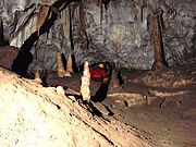
Cave system in EnglandThe Three Counties System is a set of inter-connected limestone solutional cave systems spanning the borders of Cumbria, Lancashire and North Yorkshire in the north of England. The possibility of connecting a number of discrete cave systems in the area to create a single super-system that spans the county borders was first proposed by Dave Brook in 1968, and it was achieved in 2011. The system is currently about 90 kilometres (56 mi) long, making it the longest in the UK and the thirty-fourth longest in the world, and there continues to be scope for considerably extending the system.
Read article


Top Questions
AI generatedMore questions